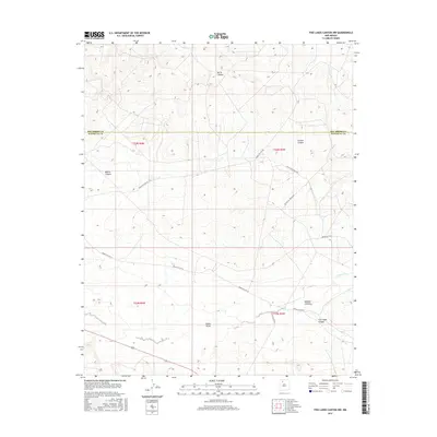
2017 Map of Five Lakes Canyon NW
USGS Topo · Published 2017About this map
Cañon Largo serves as the central drainage for this arid landscape in Northwest New Mexico, where deep canyons and washes define the geography. The survey highlights a network of Bureau of Indian Affairs infrastructure, including Indian Svc Rte 22 and Indian Svc Rte 20, which provide limited access through the township and range blocks of the high desert. Notable topographic landmarks include Burro Canyon in the north and the namesake Five Lakes Canyon to the south.
Find a feature on this map
18 named features on this map. Tap any name to fly to it.
Don’t see what you’re looking for? This feature index may not catch every label — zoom into the map to look around manually.
Map Details
Editions of this 2017 Five Lakes Canyon NW Map
This is the sole edition of this map. No revisions or reprints were ever made.
Other maps of this area

1889 · Largo
USGS Topo · 1:250,000

1895 · Largo
USGS Topo · 1:250,000

1954 · Aztec
USGS Topo · 1:250,000

1958 · Aztec
USGS Topo · 1:250,000

1962 · Aztec
USGS Topo · 1:250,000

1963 · Otero Store
USGS Topo · 1:24,000

1963 · Lindrith
USGS Topo · 1:24,000
1963 · Arroyo Chijuillita
USGS Topo · 1:24,000
1963 · Billy Rice Canyon
USGS Topo · 1:24,000
1963 · Taylor Ranch
USGS Topo · 1:24,000