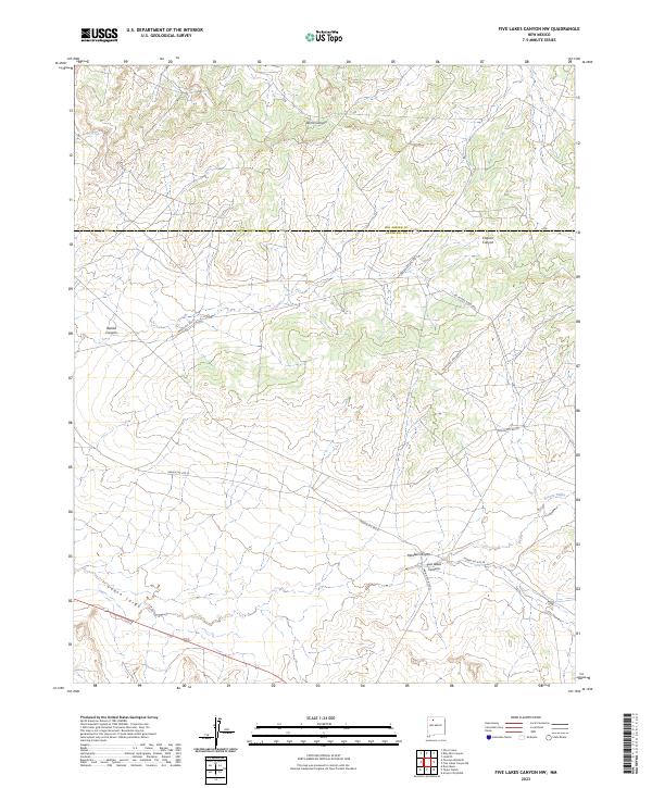
2023 Map of Five Lakes Canyon NW
USGS Topo · Published 2023About this map
Cañon Largo dominates the southwestern reach of this terrain on the border of Rio Arriba and Sandoval counties. The landscape is defined by a network of deeply etched drainages, including Five Lakes Canyon and Menfee Canyon, which feed into the larger regional hydrological system. Modern access to this remote high-desert environment relies on several Bureau of Indian Affairs routes, such as Indian Svc Rte 22 and Indian Svc Rte 20, though much of the land remains restricted by difficult passage as indicated by noted sandy roads and 4WD requirements. The intersection of these routes and the prominent Arroyo Valles reflects a modern land management pattern that respects the significant topographical obstacles of Bonita Canyon and Chacon Canyon. This survey provides a precise accounting of current drainage paths and transportation networks across the San Juan Basin floor.
Find a feature on this map
18 named features on this map. Tap any name to fly to it.
Don’t see what you’re looking for? This feature index may not catch every label — zoom into the map to look around manually.
Map Details
Editions of this 2023 Five Lakes Canyon NW Map
This is the sole edition of this map. No revisions or reprints were ever made.
Other maps of this area

1889 · Largo
USGS Topo · 1:250,000

1895 · Largo
USGS Topo · 1:250,000

1954 · Aztec
USGS Topo · 1:250,000

1958 · Aztec
USGS Topo · 1:250,000

1962 · Aztec
USGS Topo · 1:250,000

1963 · Otero Store
USGS Topo · 1:24,000

1963 · Lindrith
USGS Topo · 1:24,000
1963 · Arroyo Chijuillita
USGS Topo · 1:24,000
1963 · Billy Rice Canyon
USGS Topo · 1:24,000
1963 · Taylor Ranch
USGS Topo · 1:24,000