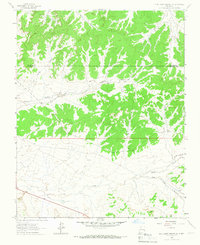
1963 Map of Five Lakes Canyon NW
USGS Topo · Published 1967About this map
The Jicarilla Indian Reservation occupies much of this high-plateau landscape, where the border of Rio Arriba County and Sandoval County cuts through a series of deep drainages. The area's geography is defined by the massive Cañon Largo and its many tributaries, including Chacon Canyon and Bonita Canyon. These canyons create a complex system of mesa tops and eroded valleys that historically challenged travel and water access.
Find a feature on this map
13 named features on this map. Tap any name to fly to it.
Don’t see what you’re looking for? This feature index may not catch every label — zoom into the map to look around manually.
Map Details
Editions of this 1963 Five Lakes Canyon NW Map
This is the sole edition of this map. No revisions or reprints were ever made.
Other maps of this area

1889 · Largo
USGS Topo · 1:250,000

1895 · Largo
USGS Topo · 1:250,000

1954 · Aztec
USGS Topo · 1:250,000

1958 · Aztec
USGS Topo · 1:250,000

1962 · Aztec
USGS Topo · 1:250,000

1963 · Otero Store
USGS Topo · 1:24,000

1963 · Lindrith
USGS Topo · 1:24,000
1963 · Arroyo Chijuillita
USGS Topo · 1:24,000
1963 · Billy Rice Canyon
USGS Topo · 1:24,000
1963 · Taylor Ranch
USGS Topo · 1:24,000