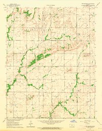
1963 Map of Five Mounds
USGS Topo · Published 1964About this map
The Old Indian Treaty Boundary carves a straight north-south line through this portion of Southeast Kansas, marking a historical division between Pleasant Valley and Chetopa townships. The landscape is defined by its distinctive upland rises, notably Dewey Mound, Three Mounds, and Long Mound, which overlook a network of meandering waterways including Pumpkin Creek and Chetopa Creek. This 1963 survey captures the area's rural character, centered on community anchors like Pleasant Valley Ch and its accompanying Pleasant Valley Cem. The presence of numerous oil wells scattered across the terrain, alongside a Quarry and a prominent Radio Tower, illustrates the mid-century industrial and communications infrastructure supporting these prairie communities near the Wilson and Neosho County line.
Find a feature on this map
17 named features on this map. Tap any name to fly to it.
Don’t see what you’re looking for? This feature index may not catch every label — zoom into the map to look around manually.
Map Details
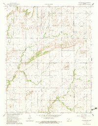
Editions of this 1963 Five Mounds Map
2 editions found
Other maps of this area

1886 · Fredonia
USGS Topo · 1:125,000

1886 · Iola
USGS Topo · 1:125,000

1886 · Independence
USGS Topo · 1:125,000

1886 · Parsons
USGS Topo · 1:125,000

1893 · Iola
USGS Topo · 1:125,000

1893 · Parsons
USGS Topo · 1:125,000

1894 · Fredonia
USGS Topo · 1:125,000

1894 · Independence
USGS Topo · 1:125,000

1904 · Iola
USGS Topo · 1:125,000

1905 · Independence
USGS Topo · 1:125,000