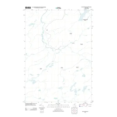
2013 Map of Five Ponds
USGS Topo · Published 2013About this map
The Oswegatchie River dominates this landscape, winding its way past High Rock and through several dramatic natural drops including High Falls and Griffin Rapids. This 2013 survey of the Five Ponds area reveals a complex hydrographic network where the Robinson River meets the Oswegatchie amidst a series of distinct peaks like Panther Mountain and Partlow Mountain. The northeastern portion of the sheet is anchored by Cranberry Lake, where Janacks Landing Shelter stands as a notable landmark for those navigating the shore. Further south, the terrain opens into The Plains near Boiling Spring, while a cluster of uniquely named water bodies, including Big Shallow, the Washbowl, and Cracker Pond, highlights the glacial character of the region. The map provides a detailed view of the drainage patterns and summits that define this pocket of the Adirondacks.
Find a feature on this map
44 named features on this map. Tap any name to fly to it.
Don’t see what you’re looking for? This feature index may not catch every label — zoom into the map to look around manually.
Map Details
Editions of this 2013 Five Ponds Map
This is the sole edition of this map. No revisions or reprints were ever made.
Other maps of this area

1903 · Big Moose
USGS Topo · 1:62,500

1912 · Number Four
USGS Topo · 1:62,500

1915 · Number Four
USGS Topo · 1:62,500

1916 · Oswegatchie
USGS Topo · 1:62,500

1918 · Oswegatchie
USGS Topo · 1:62,500

1919 · Cranberry Lake
USGS Topo · 1:62,500

1921 · Cranberry Lake
USGS Topo · 1:62,500

1931 · Cranberry Lake
USGS Topo · 1:62,500

1948 · Ogdensburg
USGS Topo · 1:250,000

1950 · Utica
USGS Topo · 1:250,000