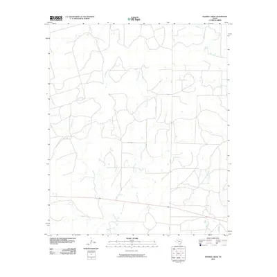
2010 Map of Fivemile Creek
USGS Topo · Published 2010About this map
Fivemile Creek and Bull Creek define the drainage patterns of this West Texas landscape in Borden County. The terrain is marked by a network of intermittent stream beds including Crooked Creek, Mesquite Creek, and Red Mud Creek, which illustrate the arid hydrological character of the region. Local travel is facilitated by a grid of rural routes such as FM 612 and several family-named thoroughfares like Miller Rd and Wicker Rd. This 2010 survey reflects a largely undeveloped pastoral or ranching environment, where the proximity of Gavett Creek and East Gavett Creek in the northeast corner suggests the subtle topographies typical of the Llano Estacado's edges. The layout of roads and lack of dense settlement points to a landscape maintained for agricultural use and resource management.
Find a feature on this map
11 named features on this map. Tap any name to fly to it.
Don’t see what you’re looking for? This feature index may not catch every label — zoom into the map to look around manually.
Map Details
Editions of this 2010 Fivemile Creek Map
This is the sole edition of this map. No revisions or reprints were ever made.
Other maps of this area

1951 · Ira NW
USGS Topo · 1:24,000

1954 · Big Spring
USGS Topo · 1:250,000

1958 · Big Spring
USGS Topo · 1:250,000

1969 · Gail NE
USGS Topo · 1:24,000

1969 · Arah
USGS Topo · 1:24,000

1969 · Beal Hollow
USGS Topo · 1:24,000

1969 · Fluvanna
USGS Topo · 1:24,000

1969 · Gail
USGS Topo · 1:24,000
1969 · Fivemile Creek
USGS Topo · 1:24,000

1970 · Mushaway Peak
USGS Topo · 1:24,000