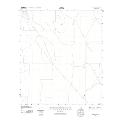
2010 Map of Fivemile Mesa
USGS Topo · Published 2010About this map
Fivemile Mesa and the expansive drainage of Sixshooter Draw characterize this West Texas landscape in the early 21st century. The terrain is marked by the distinct topographic rise of the mesa and the seasonal watercourses typical of the Trans-Pecos region. S Hwy 285 cuts a diagonal path through the quadrangle, serving as the primary transportation artery for the area. In the northwest corner, the Comanche Creek Reservoir provides a critical water feature in an otherwise arid environment. This 2010 survey reflects a period of modern ranching and infrastructure, where the vast stretches of open land are segmented by local roads and property boundaries, illustrating the enduring relationship between human transport routes and the natural landforms of Pecos County.
Find a feature on this map
4 named features on this map. Tap any name to fly to it.
Don’t see what you’re looking for? This feature index may not catch every label — zoom into the map to look around manually.
Map Details
Editions of this 2010 Fivemile Mesa Map
This is the sole edition of this map. No revisions or reprints were ever made.
Other maps of this area

1921 · Fort Stockton
USGS Topo · 1:62,500

1923 · Fort Stockton
USGS Topo · 1:62,500

1923 · Sierra Madera
USGS Topo · 1:62,500

1928 · Comanche Spring
USGS Topo · 1:125,000

1954 · Fort Stockton
USGS Topo · 1:250,000

1958 · Fort Stockton
USGS Topo · 1:250,000

1970 · Fort Stockton West
USGS Topo · 1:24,000

1970 · Twelvemile Mesa
USGS Topo · 1:24,000

1970 · East Mesa
USGS Topo · 1:24,000
1970 · East Mesa SW
USGS Topo · 1:24,000