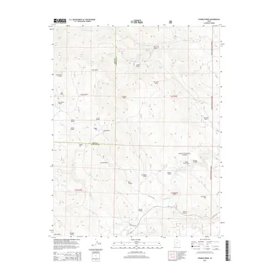
2014 Map of Fivemile Ridge
USGS Topo · Published 2014About this map
Dixie National Forest covers the high-elevation landscape of the Fivemile Ridge area along the border of Iron and Garfield Counties. This 2014 survey captures a terrain defined by complex drainage systems and prominent landforms such as Horse Bench and the Twin Peaks. The map documents numerous hollows and springs that have historically supported seasonal activity in this part of southern Utah, including Tebbs Spring and Billy Spring. A network of forest and secondary roads, including Little Valley Rd and Panguitch Lake Rd, provides access across the ridge and toward the waters of Panguitch Cr. The detailed topographic data reveals the geological character of landmarks like White Rocks and Dickinson Hill, tracing the headwaters of Threemile Cr and Caddy Cr as they carve through the high plateaus.
Find a feature on this map
45 named features on this map. Tap any name to fly to it.
Don’t see what you’re looking for? This feature index may not catch every label — zoom into the map to look around manually.
Map Details
Editions of this 2014 Fivemile Ridge Map
This is the sole edition of this map. No revisions or reprints were ever made.
Other maps of this area

1886 · Kanab
USGS Topo · 1:250,000

1953 · Cedar City
USGS Topo · 1:250,000

1958 · Cedar City
USGS Topo · 1:250,000

1958 · Panguitch Lake
USGS Topo · 1:62,500

1962 · Cedar City
USGS Topo · 1:250,000

1966 · Hatch
USGS Topo · 1:24,000

1966 · Panguitch NW
USGS Topo · 1:24,000
1971 · Cottonwood Mtn
USGS Topo · 1:24,000

1971 · Fivemile Ridge
USGS Topo · 1:24,000
1971 · Panguitch
USGS Topo · 1:24,000