
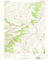
1966 Map of Hatch
USGS Topo · Published 1968About this map
Hatch and the surrounding Garfield County landscape are defined by the winding course of the Sevier River and its numerous high-desert tributaries in the mid-1960s. The settlement of Hatch is situated on a relatively level bench above the river, supported by infrastructure like the nearby Landing Strips and a local Substation. To the north, the small community of Hillsdale sits along the riverbank, marking a pocket of development amidst a topography carved by Rock Canyon and Coal Pit Wash.
Find a feature on this map
25 named features on this map. Tap any name to fly to it.
Don’t see what you’re looking for? This feature index may not catch every label — zoom into the map to look around manually.
Map Details
Editions of this 1966 Hatch Map
2 editions found
Other maps of this area

1886 · Kanab
USGS Topo · 1:250,000

1953 · Cedar City
USGS Topo · 1:250,000

1958 · Cedar City
USGS Topo · 1:250,000

1958 · Panguitch Lake
USGS Topo · 1:62,500

1962 · Cedar City
USGS Topo · 1:250,000

1966 · Wilson Peak
USGS Topo · 1:24,000

1966 · George Mtn
USGS Topo · 1:24,000
1966 · Tropic Reservoir
USGS Topo · 1:24,000

1971 · Fivemile Ridge
USGS Topo · 1:24,000
1971 · Panguitch
USGS Topo · 1:24,000