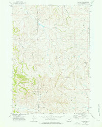
1972 Map of Flag Butte
USGS Topo · Published 1976About this map
The high plains of the Campbell County and Crook County border are defined here by a landscape of rugged draws and energy exploration in the early 1970s. Dramatic topographic features like Flag Butte and Flatiron Butte rise above the complex drainage systems of Deadman Creek and the Little Missouri River. This area represents a period of active industrial utility, marked by a high density of drill holes, oil wells, and gas wells scattered across the undulating terrain.
Find a feature on this map
25 named features on this map. Tap any name to fly to it.
Don’t see what you’re looking for? This feature index may not catch every label — zoom into the map to look around manually.
Map Details
Editions of this 1972 Flag Butte Map
2 editions found
Other maps of this area

1905 · Devils Tower
USGS Topo · 1:125,000

1918 · Moorcroft
USGS Topo · 1:125,000

1918 · Moorcroft
USGS Topo · 1:62,500

1954 · Gillette
USGS Topo · 1:250,000

1955 · Gillette
USGS Topo · 1:250,000

1957 · Moorcroft
USGS Topo · 1:62,500

1957 · Oshoto
USGS Topo · 1:62,500

1958 · Gillette
USGS Topo · 1:250,000

1962 · Gillette
USGS Topo · 1:250,000
1971 · Rozet NE
USGS Topo · 1:24,000