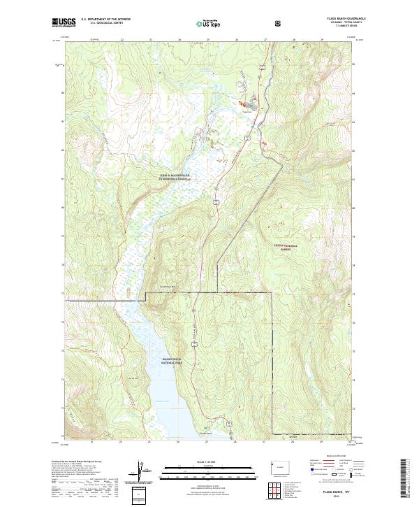
2021 Map of Flagg Ranch
USGS Topo · Published 2021About this map
Flagg Ranch serves as the central waypoint in this landscape, situated at the confluence of several key wilderness access points. The area is defined by the intersection of three major protected lands: the John D Rockefeller Jr Memorial Parkway, Grand Teton National Park, and Teton National Forest. The hydrological network is dominated by the Snake River Headwaters Wild and Scenic River and the northern reaches of Jackson Lake. These waterways are fed by numerous smaller tributaries including Lizard Cr and Polecat Cr, which drain the surrounding high ground of Steamboat Mtn and Elk Ridge. This survey captures the specialized infrastructure of a high-altitude wilderness corridor, where developed sites like Huckleberry Hot Springs exist alongside extensive backcountry routes like the Berry Creek Trl and Sheffield Trl.
Find a feature on this map
34 named features on this map. Tap any name to fly to it.
Don’t see what you’re looking for? This feature index may not catch every label — zoom into the map to look around manually.
Map Details
Editions of this 2021 Flagg Ranch Map
This is the sole edition of this map. No revisions or reprints were ever made.
Other maps of this area

1886 · Shoshone
USGS Topo · 1:125,000

1888 · Shoshone
USGS Topo · 1:125,000

1895 · Shoshone
USGS Topo · 1:125,000

1899 · Grand Teton
USGS Topo · 1:125,000

1901 · Shoshone
USGS Topo · 1:125,000

1901 · Grand Teton
USGS Topo · 1:125,000

1908 · Shoshone
USGS Topo · 1:125,000

1911 · Shoshone
USGS Topo · 1:125,000

1955 · Ashton
USGS Topo · 1:250,000

1955 · Driggs
USGS Topo · 1:250,000