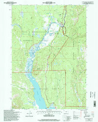
1996 Map of Flagg Ranch
USGS Topo · Published 1998About this map
Snake River waters dominate this landscape where the John D Rockefeller Jr Memorial Parkway connects two of America's most iconic preserves. The map highlights the northern reach of Jackson Lake, revealing a complex shoreline defined by landmarks such as Fonda Point and Steamboat Mountain. At the heart of the transit corridor sits Flagg Ranch, a focal point for visitors that includes a Trailer Park and essential infrastructure like a Gaging Station and Sewage Disposal Plant.
Find a feature on this map
35 named features on this map. Tap any name to fly to it.
Don’t see what you’re looking for? This feature index may not catch every label — zoom into the map to look around manually.
Map Details
Editions of this 1996 Flagg Ranch Map
This is the sole edition of this map. No revisions or reprints were ever made.
Other maps of this area

1886 · Shoshone
USGS Topo · 1:125,000

1888 · Shoshone
USGS Topo · 1:125,000

1895 · Shoshone
USGS Topo · 1:125,000

1899 · Grand Teton
USGS Topo · 1:125,000

1901 · Shoshone
USGS Topo · 1:125,000

1901 · Grand Teton
USGS Topo · 1:125,000

1908 · Shoshone
USGS Topo · 1:125,000

1911 · Shoshone
USGS Topo · 1:125,000

1955 · Ashton
USGS Topo · 1:250,000

1955 · Driggs
USGS Topo · 1:250,000