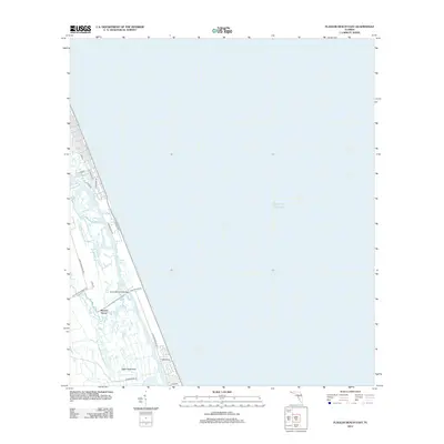
2012 Map of Flagler Beach East
USGS Topo · Published 2012About this map
Mound Grove and Tiger Hammock anchor the inland landscape of this coastal survey, where the brackish waters of the Halifax River and Bulow Cr flow parallel to the shore. The map illustrates a narrow strip of developed barrier island between the Atlantic Ocean and the coastal marshes, linked to the mainland by the Knox Memorial Bridge. Local transit is defined by historically named routes such as the John Anderson Hwy and Walter Boardman Rd, which navigate the complex network of creeks like Smith Cr. This layout highlights the intersection of early settlement sites and modern residential expansion along S Central Ave, showing how the natural hydrology of the Intracoastal region has shaped the development of the Florida coastline.
Find a feature on this map
22 named features on this map. Tap any name to fly to it.
Don’t see what you’re looking for? This feature index may not catch every label — zoom into the map to look around manually.
Map Details
Editions of this 2012 Flagler Beach East Map
This is the sole edition of this map. No revisions or reprints were ever made.
Other maps of this area

1927 · Matanzas
USGS Topo · 1:48,000

1937 · Ormond
USGS Topo · 1:48,000

1943 · Matanzas
USGS Topo · 1:62,500

1944 · Ormond
USGS Topo · 1:62,500

1944 · Matanzas
USGS Topo · 1:62,500

1954 · Daytona Beach
USGS Topo · 1:250,000

1956 · Favoretta
USGS Topo · 1:24,000

1956 · Flagler Beach East
USGS Topo · 1:24,000

1956 · Flagler Beach West
USGS Topo · 1:24,000

1956 · Ormond Beach
USGS Topo · 1:24,000