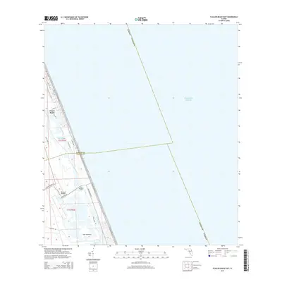
2015 Map of Flagler Beach East
USGS Topo · Published 2015About this map
Flagler Beach occupies a thin coastal strip between the Atlantic Ocean and the Intracostal Waterway in this mid-2010s survey. The landscape is defined by the complex aquatic systems of the Florida coast, where the Halifax River and Smith Creek create a network of islands and marshy inlets. Further south, the terrain shifts into the lower reaches of the Tomoka Basin and the winding course of Bulow Creek. Settlement patterns are concentrated along the primary north-south arteries like S Oceanshore Blvd, leaving large areas of the interior marshes and hammocks, such as Tiger Hammock, relatively open. Historical interest centers on the area around Mound Grove and the Knox Memorial Bridge, which provides a vital link across the coastal marshes. This survey documents the intersection of modern coastal development and the enduring natural hydrology of the Volusia and Flagler County line.
Find a feature on this map
30 named features on this map. Tap any name to fly to it.
Don’t see what you’re looking for? This feature index may not catch every label — zoom into the map to look around manually.
Map Details
Editions of this 2015 Flagler Beach East Map
This is the sole edition of this map. No revisions or reprints were ever made.
Other maps of this area

1927 · Matanzas
USGS Topo · 1:48,000

1937 · Ormond
USGS Topo · 1:48,000

1943 · Matanzas
USGS Topo · 1:62,500

1944 · Ormond
USGS Topo · 1:62,500

1944 · Matanzas
USGS Topo · 1:62,500

1954 · Daytona Beach
USGS Topo · 1:250,000

1956 · Favoretta
USGS Topo · 1:24,000

1956 · Flagler Beach East
USGS Topo · 1:24,000

1956 · Flagler Beach West
USGS Topo · 1:24,000

1956 · Ormond Beach
USGS Topo · 1:24,000