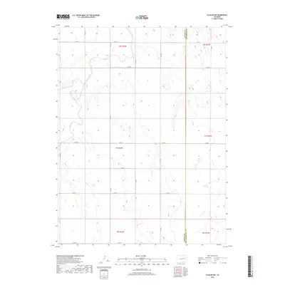
2019 Map of Flagler NW
USGS Topo · Published 2019About this map
The Arikaree River winds through this High Plains landscape, defining the hydrology of eastern Colorado near the border of Lincoln County and Kit Carson County. The terrain is characterized by a sparse network of county roads, such as Co Rd 45 and Co Rd 3y, which grid the rural townships of T6S and T7S. These routes suggest a landscape dominated by large-scale ranching or dryland farming, where the occasional drainages like Hell Creek provide the primary topographical relief. This 2019 survey documents the enduring sectional land system and the critical role of watercourses in an otherwise arid expanse. The absence of concentrated town centers highlights the isolation of this region, where life is organized around the intersection of section lines and intermittent creek beds.
Find a feature on this map
24 named features on this map. Tap any name to fly to it.
Don’t see what you’re looking for? This feature index may not catch every label — zoom into the map to look around manually.
Map Details
Editions of this 2019 Flagler NW Map
This is the sole edition of this map. No revisions or reprints were ever made.
Other maps of this area

1954 · Limon
USGS Topo · 1:250,000

1957 · Limon
USGS Topo · 1:250,000

1958 · Limon
USGS Topo · 1:250,000

1973 · Shaw
USGS Topo · 1:24,000

1977 · Thurman
USGS Topo · 1:24,000

1977 · Anton SE
USGS Topo · 1:24,000

1979 · Arriba
USGS Topo · 1:24,000

1979 · Flagler SW
USGS Topo · 1:24,000

1979 · Flagler NW
USGS Topo · 1:24,000

1979 · Flagler
USGS Topo · 1:24,000