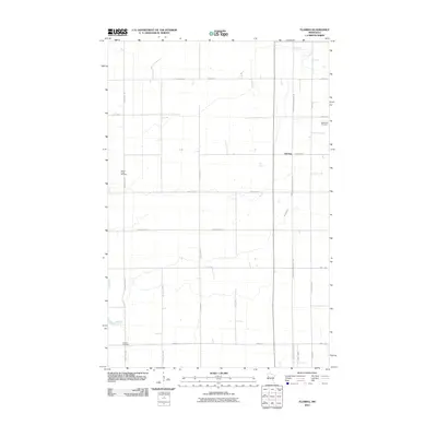
2010 Map of Flaming
USGS Topo · Published 2010About this map
Flaming serves as a central point in this agricultural landscape of Norman County, where the geometric precision of the township-and-range survey system is clearly visible. The area is defined by a rigorous grid of section lines, including County Hwy-7 and County Hwy-30, which facilitate movement between scattered farmsteads. Meandering through this structured environment, Spring Creek provides a natural contrast to the straight-edged roads as it flows across the southwestern terrain. This document is particularly valuable for genealogical research, as it preserves the locations of several burial grounds that anchor the local heritage. The Old Sundal Cemetery, Spring Creek Cemetery, and Luchau Cemetery are positioned along different corridors, reflecting the early settlement patterns and community centers established by pioneers. For those tracing the evolution of regional transit, the Agassiz Recreational Trl follows a linear path that suggests the alignment of a former railroad corridor.
Find a feature on this map
20 named features on this map. Tap any name to fly to it.
Don’t see what you’re looking for? This feature index may not catch every label — zoom into the map to look around manually.
Map Details
Editions of this 2010 Flaming Map
This is the sole edition of this map. No revisions or reprints were ever made.
Other maps of this area

1918 · Twin Valley
USGS Topo · 1:62,500

1919 · Valley
USGS Topo · 1:62,500

1952 · Grand Forks
USGS Topo · 1:250,000

1956 · Grand Forks
USGS Topo · 1:250,000

1965 · Fertile
USGS Topo · 1:24,000

1965 · Melvin
USGS Topo · 1:24,000

1965 · Waukon
USGS Topo · 1:24,000

1965 · Twin Valley SW
USGS Topo · 1:24,000

1965 · Twin Valley
USGS Topo · 1:24,000

1965 · Twin Valley NW
USGS Topo · 1:24,000