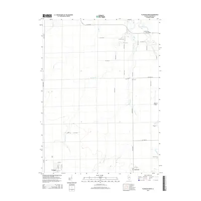
2015 Map of Flanagan North
USGS Topo · Published 2015About this map
The Vermilion River and its numerous tributaries, including Short Point Cr, Scattering Point Cr, and Morehouse Cr, define this section of the Illinois prairie. The map captures the agricultural and community layout of the mid-2010s, centered around the village of Flanagan and the smaller settlement of Graymont. For genealogists and local historians, the sheet is exceptionally detailed with rural burial sites, documenting Mount Zion Cem, High Chapel Cem, Morris Cem, and the family-associated Walden Farm Cem. The transition from town to country is marked by the grid of rural roads and the presence of the Adams RLA Number 1 Airport, while Bradley Bridge provides a key crossing over the river in the northeast. This topography shows a landscape deeply tied to its watercourses and a stable network of small-town streets and outlying farmstead cemeteries.
Find a feature on this map
44 named features on this map. Tap any name to fly to it.
Don’t see what you’re looking for? This feature index may not catch every label — zoom into the map to look around manually.
Map Details
Editions of this 2015 Flanagan North Map
This is the sole edition of this map. No revisions or reprints were ever made.
Other maps of this area

1925 · Streator
USGS Topo · 1:62,500

1927 · Streator
USGS Topo · 1:62,500

1935 · Pontiac
USGS Topo · 1:62,500

1939 · Pontiac
USGS Topo · 1:62,500

1958 · Flanagan
USGS Topo · 1:62,500

1958 · Odell
USGS Topo · 1:62,500

1958 · Aurora
USGS Topo · 1:250,000

1958 · Peoria
USGS Topo · 1:250,000

1961 · Aurora
USGS Topo · 1:250,000

1961 · Peoria
USGS Topo · 1:250,000