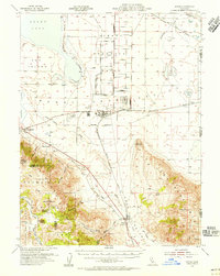
1964 Map of Flanigan
USGS Topo · Published 1982About this map
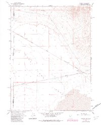
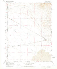
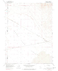
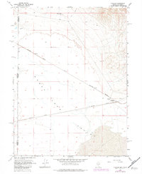
Southern Pacific and Western Pacific rail lines dominate this arid basin at the junction of the Nevada and California state line during the mid-1960s. The small settlement of Flanigan serves as a focal point for the surrounding desert landscape, featuring the Bonham Sch and local utility points such as the Flanigan Well. The map illustrates a critical transportation corridor where heavy rail infrastructure navigates the flat expanse of the Valley floor near the eastern reaches of Honey Lake.
Find a feature on this map
12 named features on this map. Tap any name to fly to it.
Don’t see what you’re looking for? This feature index may not catch every label — zoom into the map to look around manually.
Map Details
Editions of this 1964 Flanigan Map
4 editions found
Other maps of this area

1886 · Honey Lake
USGS Topo · 1:250,000

1886 · Granite Range
USGS Topo · 1:250,000

1891 · Honey Lake
USGS Topo · 1:250,000

1893 · Honey Lake
USGS Topo · 1:250,000

1894 · Granite Range
USGS Topo · 1:250,000
1954 · Wendel
USGS Topo · 1:62,500
1954 · Doyle
USGS Topo · 1:62,500

1955 · Westwood
USGS Topo · 1:250,000

1955 · Lovelock
USGS Topo · 1:250,000

1958 · Westwood
USGS Topo · 1:250,000