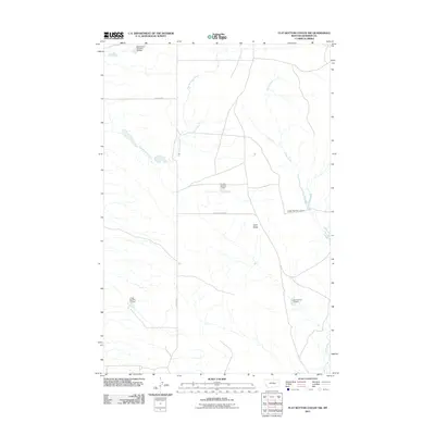
2011 Map of Flat Bottom Coulee NW
USGS Topo · Published 2011About this map
Gold Butte rises as a prominent landmark in this section of Rosebud County, where the landscape is defined by the drainage systems of East Blacktail Creek and Stellar Creek. The area is notably shaped by water management and ranching infrastructure, evidenced by numerous named reservoirs including Big Timber Number 50 Dam, Crosby Number 3 Dam, and J Galt Number 11 Dam. These features, often named after local families or livestock operations, reflect the human effort to capture runoff in a semi-arid environment. Grounded by a grid of rural routes such as Aldinger Rd and Stellar Creek Rd, the map provides a look at the geographic distribution of resources and topography in the decade following the turn of the millennium.
Find a feature on this map
10 named features on this map. Tap any name to fly to it.
Don’t see what you’re looking for? This feature index may not catch every label — zoom into the map to look around manually.
Map Details
Editions of this 2011 Flat Bottom Coulee NW Map
This is the sole edition of this map. No revisions or reprints were ever made.
Other maps of this area

1954 · Forsyth
USGS Topo · 1:250,000

1957 · Forsyth
USGS Topo · 1:250,000

1958 · Forsyth
USGS Topo · 1:250,000

1960 · Brown Coulee
USGS Topo · 1:24,000

1960 · Zempel Lake
USGS Topo · 1:24,000

1965 · Acorn Flats
USGS Topo · 1:24,000

1965 · Vanstel
USGS Topo · 1:24,000

1965 · Stellar Lake
USGS Topo · 1:24,000

1969 · Flat Bottom Coulee SW
USGS Topo · 1:24,000

1969 · Flat Bottom Coulee NE
USGS Topo · 1:24,000