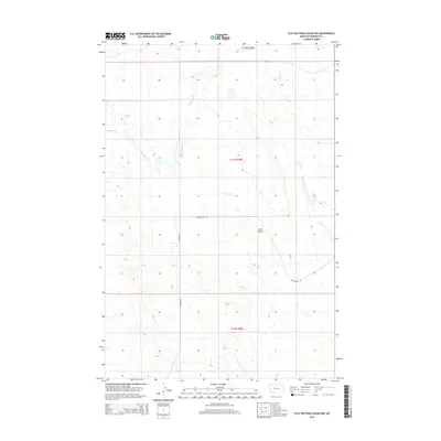
2014 Map of Flat Bottom Coulee NW
USGS Topo · Published 2014About this map
Gold Butte rises as a prominent landmark in this open Montana landscape, serving as a focal point for a region defined by extensive public land management and seasonal watercourses. The drainage patterns of E Blacktail Cr and Stellar Cr carve through the high plains, illustrating the hydrologic character of Rosebud County. The map details the transition between various townships, including t11n r38e and t10n r38e, where the Public Land Survey System grid meets the practical necessities of ranching and resource access. Transportation in this era relies on a network of unpaved corridors such as Aldinger Rd and designated BLM Access Rd routes, which facilitate movement across the wide-open terrain. These features reflect the 21st-century configuration of rural Rosebud County, where topography and government land use remain the primary drivers of human activity.
Find a feature on this map
9 named features on this map. Tap any name to fly to it.
Don’t see what you’re looking for? This feature index may not catch every label — zoom into the map to look around manually.
Map Details
Editions of this 2014 Flat Bottom Coulee NW Map
This is the sole edition of this map. No revisions or reprints were ever made.
Other maps of this area

1954 · Forsyth
USGS Topo · 1:250,000

1957 · Forsyth
USGS Topo · 1:250,000

1958 · Forsyth
USGS Topo · 1:250,000

1960 · Brown Coulee
USGS Topo · 1:24,000

1960 · Zempel Lake
USGS Topo · 1:24,000

1965 · Acorn Flats
USGS Topo · 1:24,000

1965 · Vanstel
USGS Topo · 1:24,000

1965 · Stellar Lake
USGS Topo · 1:24,000

1969 · Flat Bottom Coulee SW
USGS Topo · 1:24,000

1969 · Flat Bottom Coulee NE
USGS Topo · 1:24,000