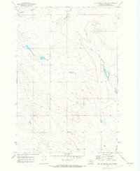
1969 Map of Flat Bottom Coulee NW
USGS Topo · Published 1973About this map
Gold Butte rises as a prominent landmark amidst the drainage network of eastern Montana in this late 1960s topographic study. The landscape is defined by the winding course of Blacktail Creek and its tributary, East Blacktail Creek, which cut through the coulees of Rosebud County. The map captures a transition in terrain where the water-carved breaks provide a stark contrast to the surrounding high plains. Access through this sparsely populated cattle country is primarily facilitated by the Stellar Creek Road, which follows the path of Stellar Creek through the eastern half of the quadrangle. The lack of established townsites or schoolhouses underscores the remote, ranch-based economy of the region during this period, focusing instead on the natural topography and the surveyed township boundaries that organize the open range.
Find a feature on this map
8 named features on this map. Tap any name to fly to it.
Don’t see what you’re looking for? This feature index may not catch every label — zoom into the map to look around manually.
Map Details
Editions of this 1969 Flat Bottom Coulee NW Map
This is the sole edition of this map. No revisions or reprints were ever made.
Other maps of this area

1954 · Forsyth
USGS Topo · 1:250,000

1957 · Forsyth
USGS Topo · 1:250,000

1958 · Forsyth
USGS Topo · 1:250,000

1960 · Brown Coulee
USGS Topo · 1:24,000

1960 · Zempel Lake
USGS Topo · 1:24,000

1965 · Acorn Flats
USGS Topo · 1:24,000

1965 · Vanstel
USGS Topo · 1:24,000

1965 · Stellar Lake
USGS Topo · 1:24,000

1969 · Flat Bottom Coulee SW
USGS Topo · 1:24,000

1969 · Flat Bottom Coulee NE
USGS Topo · 1:24,000