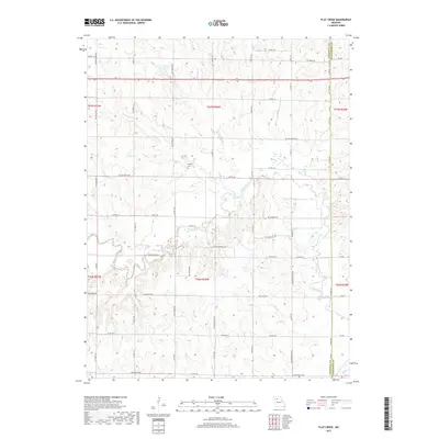
2017 Map of Flat Creek
USGS Topo · Published 2017About this map
Shoal Creek meanders through the heart of this North Central Missouri landscape, where the agricultural grid of Caldwell and Livingston Counties meets a network of rural routes and farmsteads. The 2017 survey reveals a terrain defined by its watercourses, including the notable Panther Cr and Turkey Cr which drain into the larger creek systems. For genealogists and local historians, the Guffey Cem serves as a significant landmark of early settlement patterns in the region. The map captures a primarily rural character, punctuated by smaller bodies of water like Owens Lake and Sieck Lake. A complex web of county roads, such as NE Catawba Rd and State Hwy A, provides a detailed view of the infrastructure connecting these farming communities across several townships.
Find a feature on this map
78 named features on this map. Tap any name to fly to it.
Don’t see what you’re looking for? This feature index may not catch every label — zoom into the map to look around manually.
Map Details
Editions of this 2017 Flat Creek Map
This is the sole edition of this map. No revisions or reprints were ever made.
Other maps of this area

1921 · Chillicothe
USGS Topo · 1:62,500

1922 · Gallatin
USGS Topo · 1:62,500

1923 · Chillicothe
USGS Topo · 1:62,500

1924 · Dawn
USGS Topo · 1:62,500

1924 · Braymer
USGS Topo · 1:62,500

1950 · Plymouth
USGS Topo · 1:24,000

1951 · Utica
USGS Topo · 1:62,500

1953 · Moberly
USGS Topo · 1:250,000

1954 · Moberly
USGS Topo · 1:250,000

1957 · Moberly
USGS Topo · 1:250,000