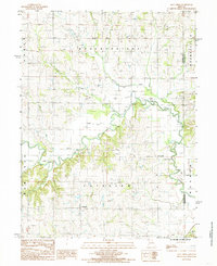
1984 Map of Flat Creek
USGS Topo · Published 1985About this map
Shoal Creek meanders through this portion of Caldwell County, Missouri, during the early 1980s, creating a complex drainage network that defines the local agriculture and infrastructure. The map details a landscape managed by extensive Levee systems along the winding banks of Panther Creek and Flat Creek, reflecting the ongoing efforts to control the floodplain for cultivation. Small agricultural hubs like Proctorville and Catawba serve as the primary points of settlement in a region marked by rural townships including Fairview, Breckenridge, and New York. Genealogists may find interest in the several unmarked Cem locations positioned near the creek forks. The transition from natural waterways to engineered solutions is most evident in the south, where Mud Creek Ditch represents a significant modification of the natural hydrology at the Livingston County line.
Find a feature on this map
15 named features on this map. Tap any name to fly to it.
Don’t see what you’re looking for? This feature index may not catch every label — zoom into the map to look around manually.
Map Details
Editions of this 1984 Flat Creek Map
This is the sole edition of this map. No revisions or reprints were ever made.
Other maps of this area

1921 · Chillicothe
USGS Topo · 1:62,500

1922 · Gallatin
USGS Topo · 1:62,500

1923 · Chillicothe
USGS Topo · 1:62,500

1924 · Dawn
USGS Topo · 1:62,500

1924 · Braymer
USGS Topo · 1:62,500

1950 · Plymouth
USGS Topo · 1:24,000

1951 · Utica
USGS Topo · 1:62,500

1953 · Moberly
USGS Topo · 1:250,000

1954 · Moberly
USGS Topo · 1:250,000

1957 · Moberly
USGS Topo · 1:250,000