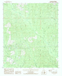
1984 Map of Flat Creek
USGS Topo · Published 1985About this map
The Louisiana Meridian bisects this landscape in the mid-1980s, revealing a terrain heavily defined by its complex network of seasonal and perennial drainage. This part of Winn Parish is centered around the small settlement of Flat Creek, where the local road system navigates through a dense system of waterways. To the southwest, Murray Junction serves as a notable crossroads near the path of Sandy Creek. The map is particularly rich in family-named and descriptive water features, from the northern flows of Oxpen Creek and Caney Creek to the southern reaches of Tiger Creek and Little Pole Log Creek. The land use pattern, as indicated by the numerous creek branches such as Godfrey Branch and Pool Branch, suggests a landscape shaped by timber and light agriculture, where the topography dictates the placement of transit routes through the Piney Woods Creek basin.
Find a feature on this map
21 named features on this map. Tap any name to fly to it.
Don’t see what you’re looking for? This feature index may not catch every label — zoom into the map to look around manually.
Map Details
Editions of this 1984 Flat Creek Map
This is the sole edition of this map. No revisions or reprints were ever made.
Other maps of this area

1949 · Jonesboro
USGS Topo · 1:62,500

1950 · Jonesboro
USGS Topo · 1:62,500

1950 · Winnfield
USGS Topo · 1:62,500

1951 · Winnfield
USGS Topo · 1:62,500

1953 · Alexandria
USGS Topo · 1:250,000

1954 · Sikes
USGS Topo · 1:62,500

1954 · Tullos
USGS Topo · 1:62,500

1955 · Shreveport
USGS Topo · 1:250,000

1955 · Alexandria
USGS Topo · 1:250,000

1956 · Shreveport
USGS Topo · 1:250,000