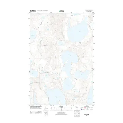
2013 Map of Flat Lake
USGS Topo · Published 2013About this map
Glacial lakes and wetlands define this portion of Becker County, where the headwaters of the Buffalo River and the Otter Tail River begin their respective journeys toward the Red River and the Hudson Bay drainage. The landscape is dotted with prominent water bodies such as Flat Lake, Cotton Lake, and Pine Lake, interspersed with smaller basins like N Momb Lake and Balsam Lake. Evidence of early 21st-century forestry and fire management is visible via the Little Flat Lake Lookout Tower and the Flat Lake Lookout Tower. Cultural markers are sparse but significant for local history, notably the Egelund Lutheran Cem situated near Fingalson Rd. The area known as Sugar Bush in the northeast corner suggests a legacy of maple syrup production, while the network of local roads like Yellow Head Trl and Bakken Rd provide access through the dense lake country.
Find a feature on this map
46 named features on this map. Tap any name to fly to it.
Don’t see what you’re looking for? This feature index may not catch every label — zoom into the map to look around manually.
Map Details
Editions of this 2013 Flat Lake Map
This is the sole edition of this map. No revisions or reprints were ever made.
Other maps of this area

1953 · Brainerd
USGS Topo · 1:250,000

1954 · Bemidji
USGS Topo · 1:250,000

1957 · Brainerd
USGS Topo · 1:250,000

1957 · Bemidji
USGS Topo · 1:250,000

1958 · Bemidji
USGS Topo · 1:250,000

1958 · Brainerd
USGS Topo · 1:250,000

1959 · Toad Mountain
USGS Topo · 1:24,000

1959 · Flat Lake
USGS Topo · 1:24,000

1959 · Rochert
USGS Topo · 1:24,000

1959 · Richwood
USGS Topo · 1:24,000