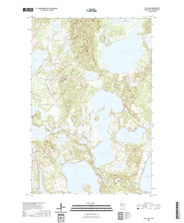
2022 Map of Flat Lake
USGS Topo · Published 2022About this map
The Buffalo River and Egg River flow through this water-rich pocket of Becker County, where glacial depressions have created a dense network of lakes and wetlands. The landscape is defined by the transition between major bodies like Flat Lake and Cotton Lake, connected by smaller waters such as Balsam Lake and the Twin Lakes. This 2022 survey documents a contemporary recreation and conservation area, highlighted by the North Country National Scenic Trl which winds through the eastern portion of the quadrangle. Local history and genealogy interests are anchored by the Egelund Cem located off Co Rd 26. The map details a specialized road network including Yellow Head Trl and Old-Indian Trl, reflecting both the historic pathways and modern access routes to the numerous shoreline properties and the local Visitor Center.
Find a feature on this map
60 named features on this map. Tap any name to fly to it.
Don’t see what you’re looking for? This feature index may not catch every label — zoom into the map to look around manually.
Map Details
Editions of this 2022 Flat Lake Map
This is the sole edition of this map. No revisions or reprints were ever made.
Other maps of this area

1953 · Brainerd
USGS Topo · 1:250,000

1954 · Bemidji
USGS Topo · 1:250,000

1957 · Brainerd
USGS Topo · 1:250,000

1957 · Bemidji
USGS Topo · 1:250,000

1958 · Bemidji
USGS Topo · 1:250,000

1958 · Brainerd
USGS Topo · 1:250,000

1959 · Toad Mountain
USGS Topo · 1:24,000

1959 · Flat Lake
USGS Topo · 1:24,000

1959 · Rochert
USGS Topo · 1:24,000

1959 · Richwood
USGS Topo · 1:24,000