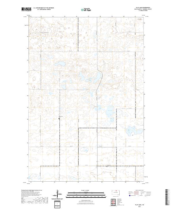
2021 Map of Flat Lake
USGS Topo · Published 2021About this map
Friedenstahl Cem and Sutley Cem anchor this section of Campbell County, serving as markers of the rural families that settled this portion of the northern plains. The landscape is defined by its glacial prairie potholes and seasonal water bodies, most notably the central Flat Lake and its neighbor East Flat Lake. Further north, Lindemann Lakes dots the terrain, illustrating the natural drainage patterns of the region. The map shows a strictly organized grid of township roads, including 120th St and 319th Ave, which partition the land into the traditional sections of the Public Land Survey System. This documentation of the 2020s landscape reveals the enduring isolation and agricultural character of South Dakota's borderlands, where name-labels are sparse but geographically significant.
Find a feature on this map
22 named features on this map. Tap any name to fly to it.
Don’t see what you’re looking for? This feature index may not catch every label — zoom into the map to look around manually.
Map Details
Editions of this 2021 Flat Lake Map
This is the sole edition of this map. No revisions or reprints were ever made.
Other maps of this area

1954 · Aberdeen
USGS Topo · 1:250,000

1956 · Aberdeen
USGS Topo · 1:250,000

1978 · Salt Lake
USGS Topo · 1:24,000

1978 · Bowdle-Hosmer Lake
USGS Topo · 1:24,000

1978 · Java SE
USGS Topo · 1:24,000

1978 · Eureka West
USGS Topo · 1:24,000
1978 · Java
USGS Topo · 1:24,000

1978 · Flat Lake
USGS Topo · 1:24,000

1978 · Feinstein Lake
USGS Topo · 1:24,000

1978 · Mutske Lake
USGS Topo · 1:24,000