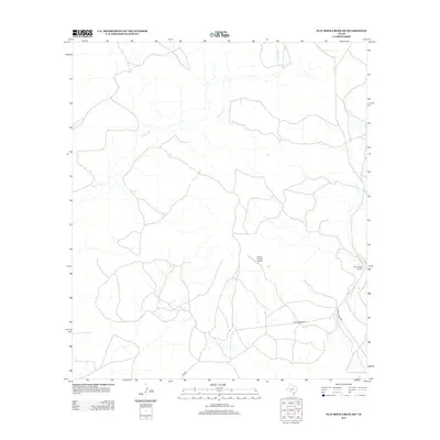
2013 Map of Flat Rock Creek SW
USGS Topo · Published 2013About this map
Sycamore Creek winds through this arid expanse of Val Verde County, defining a landscape shaped by intermittent watercourses and isolated ranching infrastructure. The drainage network is further supported by Cow Creek, which cuts through the northeastern corner of the quadrangle. Human presence is concentrated around transport and aviation, with the Lewis Private Airport and Horn Ranch Airport serving as critical links for this remote territory. The road system is dominated by rural corridors including Ranch Road 2523, Ranch Road 3008, and Fm 2523, which provide the primary access through the scrubland. This map reveals the modern spatial arrangement of private ranching interests, where personal airstrips are as vital to regional connectivity as the secondary highway system.
Find a feature on this map
7 named features on this map. Tap any name to fly to it.
Don’t see what you’re looking for? This feature index may not catch every label — zoom into the map to look around manually.
Map Details
Editions of this 2013 Flat Rock Creek SW Map
This is the sole edition of this map. No revisions or reprints were ever made.
Other maps of this area

1941 · Standart
USGS Topo · 1:62,500

1943 · Standart
USGS Topo · 1:62,500

1943 · Del Rio
USGS Topo · 1:62,500

1944 · Flat Rock
USGS Topo · 1:62,500

1944 · Devils Lake
USGS Topo · 1:62,500

1958 · Del Rio
USGS Topo · 1:250,000

1964 · Del Rio
USGS Topo · 1:250,000

1972 · Miers Ranch
USGS Topo · 1:24,000

1972 · Rough Canyon SE
USGS Topo · 1:24,000
1972 · Del Rio NE
USGS Topo · 1:24,000