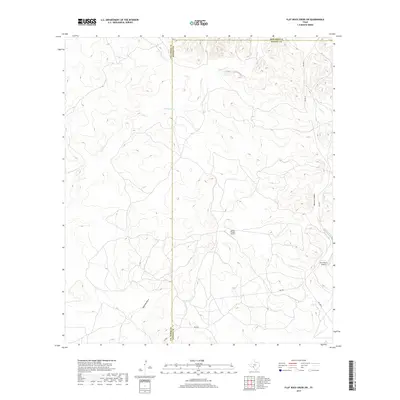
2019 Map of Flat Rock Creek SW
USGS Topo · Published 2019About this map
The intersection of Val Verde, Kinney, and Edwards counties defines this high-desert landscape in Southwest Texas. Water management and drainage patterns are the primary features of the terrain, characterized by the winding path of Sycamore Cr and the deeply etched Maurice Canyon in the eastern portion of the sheet. The sparse road network is centered on RM 2523, which provides the primary access through these ranchlands. Private aviation is a distinct component of the local economy and land use, evidenced by the presence of the Lewis Private Airport and Horn Ranch Airport. These isolated airstrips, along with features like Javelina Draw, reflect the expansive nature of ranch operations in this part of the state, where significant distances between settlements make private flight a practical necessity for remote property management.
Find a feature on this map
11 named features on this map. Tap any name to fly to it.
Don’t see what you’re looking for? This feature index may not catch every label — zoom into the map to look around manually.
Map Details
Editions of this 2019 Flat Rock Creek SW Map
This is the sole edition of this map. No revisions or reprints were ever made.
Other maps of this area

1941 · Standart
USGS Topo · 1:62,500

1943 · Standart
USGS Topo · 1:62,500

1943 · Del Rio
USGS Topo · 1:62,500

1944 · Flat Rock
USGS Topo · 1:62,500

1944 · Devils Lake
USGS Topo · 1:62,500

1958 · Del Rio
USGS Topo · 1:250,000

1964 · Del Rio
USGS Topo · 1:250,000

1972 · Miers Ranch
USGS Topo · 1:24,000

1972 · Rough Canyon SE
USGS Topo · 1:24,000
1972 · Del Rio NE
USGS Topo · 1:24,000