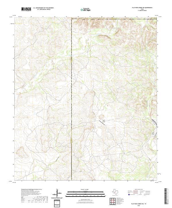
2022 Map of Flat Rock Creek SW
USGS Topo · Published 2022About this map
The Val Verde and Kinney County borders converge in this part of West Texas, where the landscape is defined by the drainage networks of Sycamore Cr, Cow Cr, and the seasonal Javelina Draw. The terrain is deeply carved by features like Maurice Canyon, reflecting the arid geography of the Edwards Plateau region. Human activity is centered on ranching and aviation infrastructure, indicated by the presence of the Lewis Private Airport and the Horn Ranch Airport. This 2022 survey documents the contemporary road network, including RM 2523 and FM 2523, which provide access to these isolated properties and ranch holdings along the county lines.
Find a feature on this map
12 named features on this map. Tap any name to fly to it.
Don’t see what you’re looking for? This feature index may not catch every label — zoom into the map to look around manually.
Map Details
Editions of this 2022 Flat Rock Creek SW Map
This is the sole edition of this map. No revisions or reprints were ever made.
Other maps of this area

1941 · Standart
USGS Topo · 1:62,500

1943 · Standart
USGS Topo · 1:62,500

1943 · Del Rio
USGS Topo · 1:62,500

1944 · Flat Rock
USGS Topo · 1:62,500

1944 · Devils Lake
USGS Topo · 1:62,500

1958 · Del Rio
USGS Topo · 1:250,000

1964 · Del Rio
USGS Topo · 1:250,000

1972 · Miers Ranch
USGS Topo · 1:24,000

1972 · Rough Canyon SE
USGS Topo · 1:24,000
1972 · Del Rio NE
USGS Topo · 1:24,000