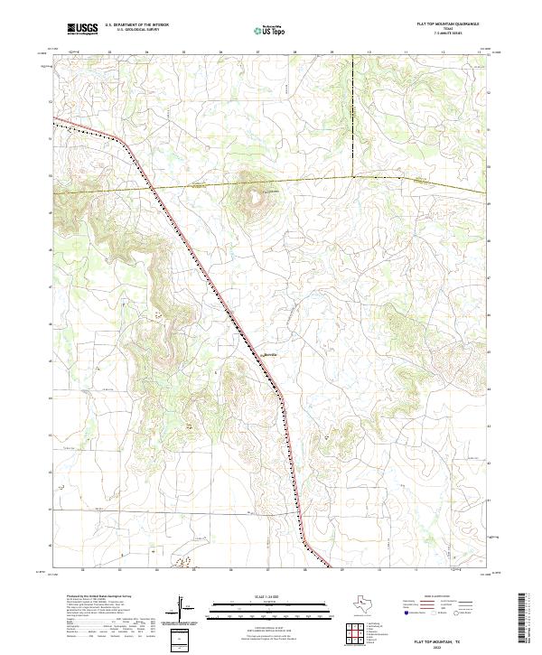
2022 Map of Flat Top Mountain
USGS Topo · Published 2022About this map
The settlement of Fullerville sits along a prominent north-south transportation corridor in this western Texas landscape, positioned where the High Plains transition into the rolling breaks of the Brazos River watershed. The terrain is defined by its drainage network, featuring Rocky Cr, Grape Cr, and Little Grape Cr, which carve through the elevations of the Rolling Plains. A primary landmark in the northern portion of the map is Flat Top Mtn, a distinctive mesa that serves as a topographical anchor near the intersection of the Garza, Kent, and Scurry county boundaries. Local ranching access is highlighted by roads such as Lp Fuller Ranch Rd and Fm 612, which connect remote homesteads across the arid brushland. This 2022 survey documents the modern rural infrastructure and water courses that have dictated land use in this tri-county region for generations.
Find a feature on this map
19 named features on this map. Tap any name to fly to it.
Don’t see what you’re looking for? This feature index may not catch every label — zoom into the map to look around manually.
Map Details
Editions of this 2022 Flat Top Mountain Map
This is the sole edition of this map. No revisions or reprints were ever made.
Other maps of this area

1954 · Dermott
USGS Topo · 1:24,000

1954 · Brand
USGS Topo · 1:24,000

1954 · Lubbock
USGS Topo · 1:250,000

1954 · Big Spring
USGS Topo · 1:250,000

1958 · Big Spring
USGS Topo · 1:250,000

1969 · Arah
USGS Topo · 1:24,000

1969 · Justiceburg SE
USGS Topo · 1:24,000

1969 · Fluvanna
USGS Topo · 1:24,000

1969 · Justiceburg
USGS Topo · 1:24,000

1969 · Flat Top Mountain
USGS Topo · 1:24,000