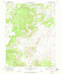
1969 Map of Flattop Mtn
USGS Topo · Published 1972About this map
Price River carves a deep canyon through the northern reaches of this Emery County landscape, where the high desert terrain is defined by dramatic erosion and seasonal watercourses. The central elevation of Flattop Mtn stands as a primary landmark, surrounded by a network of drainage systems including Sulphur Gulch, Stave Wash, and the aptly named Humbug Wash. This 1969 field check captures a wilderness area largely inaccessible except by the various jeep trails that navigate the plateaus and benches.
Find a feature on this map
24 named features on this map. Tap any name to fly to it.
Don’t see what you’re looking for? This feature index may not catch every label — zoom into the map to look around manually.
Map Details
Editions of this 1969 Flattop Mtn Map
2 editions found
Other maps of this area

1886 · Price River
USGS Topo · 1:250,000

1896 · Price River
USGS Topo · 1:250,000

1948 · Woodside
USGS Topo · 1:62,500

1949 · Woodside
USGS Topo · 1:62,500

1950 · Woodside
USGS Topo · 1:62,500

1956 · Price
USGS Topo · 1:250,000

1960 · Price
USGS Topo · 1:250,000

1962 · Price
USGS Topo · 1:250,000
1969 · Dry Mesa
USGS Topo · 1:24,000

1969 · Olsen Reservoir
USGS Topo · 1:24,000