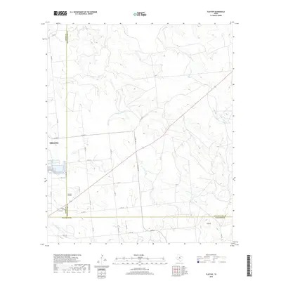
2019 Map of Flattop
USGS Topo · Published 2019About this map
Spring Cr and its tributaries, including W Fork Spring Cr and S Prong Long Cr, carve through the West Texas landscape where the borders of Jones, Shackelford, and Callahan counties converge. The terrain is defined by its drainage patterns and the prominent rise of Flattop in the southeast corner. This area northeast of Abilene remains largely rural, characterized by a network of county roads like Wildcat Rd and Ranch Rd 604 that connect dispersed ranching properties.
Find a feature on this map
33 named features on this map. Tap any name to fly to it.
Don’t see what you’re looking for? This feature index may not catch every label — zoom into the map to look around manually.
Map Details
Editions of this 2019 Flattop Map
This is the sole edition of this map. No revisions or reprints were ever made.
Other maps of this area

1890 · Abilene
USGS Topo · 1:125,000

1891 · Anson
USGS Topo · 1:125,000

1892 · Abilene
USGS Topo · 1:125,000

1892 · Albany
USGS Topo · 1:125,000

1893 · Albany
USGS Topo · 1:125,000

1893 · Anson
USGS Topo · 1:125,000

1931 · Baird
USGS Topo · 1:125,000

1932 · Baird
USGS Topo · 1:125,000

1954 · Abilene
USGS Topo · 1:250,000

1957 · Kirby Lake
USGS Topo · 1:62,500