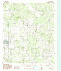
1984 Map of Flattop
USGS Topo · Published 1984About this map
The tri-county junction of Jones, Shackelford, and Callahan counties defines this West Texas landscape during the early 1980s. Centered on the community of Flattop, the map reveals a terrain carved by the drainage systems of Deadman Creek and the meandering Spring Creek. The area’s infrastructure is clearly documented, showing an underground telephone cable and pipeline network that crisscrosses the rural acreage, alongside several industrial Gravel Pit operations.
Find a feature on this map
11 named features on this map. Tap any name to fly to it.
Don’t see what you’re looking for? This feature index may not catch every label — zoom into the map to look around manually.
Map Details
Editions of this 1984 Flattop Map
This is the sole edition of this map. No revisions or reprints were ever made.
Other maps of this area

1890 · Abilene
USGS Topo · 1:125,000

1891 · Anson
USGS Topo · 1:125,000

1892 · Abilene
USGS Topo · 1:125,000

1892 · Albany
USGS Topo · 1:125,000

1893 · Albany
USGS Topo · 1:125,000

1893 · Anson
USGS Topo · 1:125,000

1931 · Baird
USGS Topo · 1:125,000

1932 · Baird
USGS Topo · 1:125,000

1954 · Abilene
USGS Topo · 1:250,000

1957 · Kirby Lake
USGS Topo · 1:62,500