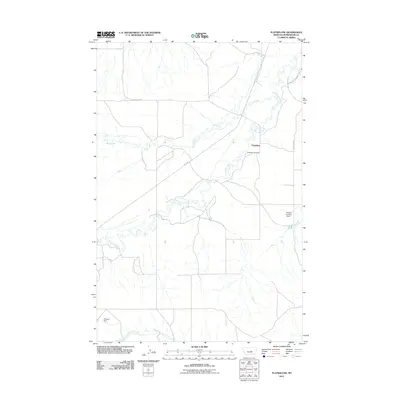
2011 Map of Flatwillow
USGS Topo · Published 2011About this map
Flatwillow anchors this Petroleum County landscape, characterized by the winding path of Flatwillow Creek and its convergence with Pike Creek. This rural Montana survey illustrates a land defined by water management and transit, where livestock and agriculture rely on features like Sharkey Number 1 Dam and Eliasson Dam. The settlement pattern is sparse, with the local history of the area centered around the Flatwillow Cemetery and the junction of Rte 244 and Pike Creek Rd. To the south, the terrain descends toward Little Wall Creek, showing the drainage patterns typical of the high plains. The map provides a clear look at the road network, including the gravel stretches of Flatwillow Rd that connect these remote ranching outposts to the wider region.
Find a feature on this map
10 named features on this map. Tap any name to fly to it.
Don’t see what you’re looking for? This feature index may not catch every label — zoom into the map to look around manually.
Map Details
Editions of this 2011 Flatwillow Map
This is the sole edition of this map. No revisions or reprints were ever made.
Other maps of this area

1954 · Roundup
USGS Topo · 1:250,000

1958 · Roundup
USGS Topo · 1:250,000

1986 · Snoose Creek
USGS Topo · 1:24,000

1986 · Lake Mason NE
USGS Topo · 1:24,000

1986 · Flatwillow
USGS Topo · 1:24,000

1986 · Pike Creek Hills East
USGS Topo · 1:24,000

1986 · Crowley Dam
USGS Topo · 1:24,000

1986 · Big Wall NW
USGS Topo · 1:24,000
1986 · Yellow Water Reservoir
USGS Topo · 1:24,000
1986 · Jim Coulee
USGS Topo · 1:24,000