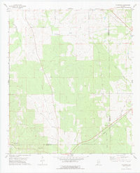
1978 Map of Flatwood
USGS Topo · Published 1979About this map
Chickasaw Bogue and its numerous tributaries, including Bokok Creek and Martin Creek, dominate this portion of the Marengo and Wilcox county line in the late 1970s. The landscape reflects a transition from early transportation routes to modern infrastructure, centered near the settlement of Flatwood. The path of the Southern railroad cuts through the southeastern corner, paralleled in places by the intriguing Old Red Railroad Grade, which suggests an older, perhaps re-routed or superseded rail bed that predates the modern line.
Find a feature on this map
17 named features on this map. Tap any name to fly to it.
Don’t see what you’re looking for? This feature index may not catch every label — zoom into the map to look around manually.
Map Details
Editions of this 1978 Flatwood Map
This is the sole edition of this map. No revisions or reprints were ever made.
Other maps of this area

1953 · Montgomery
USGS Topo · 1:250,000

1956 · Montgomery
USGS Topo · 1:250,000

1957 · Montgomery
USGS Topo · 1:250,000

1968 · Thomaston East
USGS Topo · 1:24,000

1968 · Thomaston West
USGS Topo · 1:24,000

1968 · Central Mills
USGS Topo · 1:24,000

1974 · Catherine
USGS Topo · 1:24,000
1974 · Lee Long Bridge
USGS Topo · 1:24,000

1978 · Surginer
USGS Topo · 1:24,000
1978 · Kimbrough
USGS Topo · 1:24,000