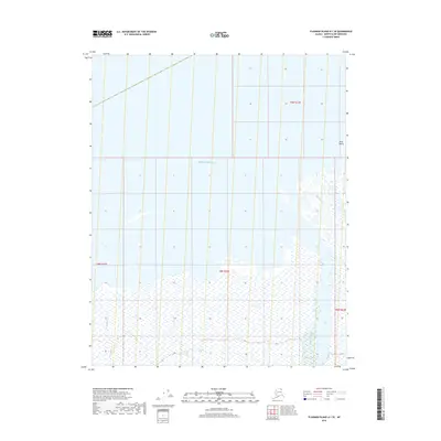
2018 Map of Flaxman Island A-1 SE
USGS Topo · Published 2018About this map
The Beaufort Sea coast of the North Slope defines this landscape where the tundra meets the Arctic Ocean. The drainage network is characterized by the convergence of the Okpilak River and the Hulahula River as they flow into the delta region, creating a complex environment of wetlands and shifting channels. This coastal stretch is further shaped by Katakturuk Cr and Natararok Cr, which navigate the low-lying terrain before reaching the sea. Just offshore, Arey Island serves as a distinct barrier feature along the northern edge of the mainland. The area's geography is fundamentally tied to these seasonal waterways, which dictate the character of the shore and the surrounding plains in this remote section of the Alaskan Arctic.
Find a feature on this map
10 named features on this map. Tap any name to fly to it.
Don’t see what you’re looking for? This feature index may not catch every label — zoom into the map to look around manually.
Map Details
Editions of this 2018 Flaxman Island A-1 SE Map
This is the sole edition of this map. No revisions or reprints were ever made.
Other maps of this area

1951 · Barter Island
USGS Topo · 1:250,000

1951 · Demarcation Point
USGS Topo · 1:250,000

1951 · Mt. Michelson
USGS Topo · 1:250,000

1955 · Flaxman Island
USGS Topo · 1:250,000

1955 · Demarcation Point
USGS Topo · 1:250,000

1955 · Flaxman Island A-1
USGS Topo · 1:63,360

1955 · Barter Island A-5
USGS Topo · 1:63,360

1955 · Mount Michelson D-1
USGS Topo · 1:63,360

1955 · Demarcation Point D-5
USGS Topo · 1:63,360

1956 · Mt. Michelson
USGS Topo · 1:250,000