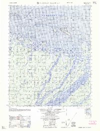
1962 Map of Flaxman Island A-4
USGS Topo · Published 1962About this map
Flaxman Island sits at the edge of the Beaufort Sea in this early 1960s Army Map Service compilation, revealing a landscape defined by shifting sands and Arctic waterways. Along the island's southern coast, an (abandoned site) marks a point of former human activity, while a solitary Tractor Trail provides the only overland passage across the tundra. The complex coastal geography includes the Maguire Islands chain, featuring Duchess Island and North Star Island, which buffer the mainland from the open sea.
Find a feature on this map
11 named features on this map. Tap any name to fly to it.
Don’t see what you’re looking for? This feature index may not catch every label — zoom into the map to look around manually.
Map Details
Editions of this 1962 Flaxman Island A-4 Map
This is the sole edition of this map. No revisions or reprints were ever made.
Other maps of this area

1951 · Mt. Michelson
USGS Topo · 1:250,000

1955 · Flaxman Island
USGS Topo · 1:250,000

1955 · Mount Michelson D-5
USGS Topo · 1:63,360

1955 · Mount Michelson D-3
USGS Topo · 1:63,360

1955 · Mount Michelson D-4
USGS Topo · 1:63,360

1955 · Flaxman Island A-5
USGS Topo · 1:63,360

1955 · Flaxman Island A-4
USGS Topo · 1:63,360

1955 · Flaxman Island A-3
USGS Topo · 1:63,360
1955 · Flaxman Island B-5
USGS Topo · 1:63,360

1956 · Mt. Michelson
USGS Topo · 1:250,000