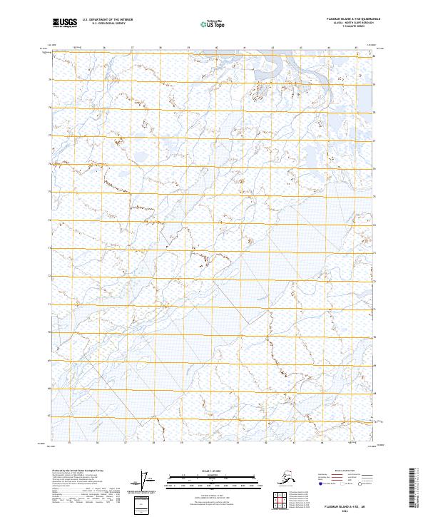
2024 Map of Flaxman Island A-4 SE
USGS Topo · Published 2024About this map
Arctic National Wildlife Refuge encompasses the majority of this coastal landscape on the North Slope, where a complex network of wetlands and braided waterways dominates the terrain. The eastern edge is defined by the wandering course of the Canning River, while the western portion is marked by the Staines River as it moves toward the Beaufort Sea. These river systems are characteristic of the Arctic coastal plain, featuring vast marshlands and shifting channels that have remained largely undisturbed by permanent infrastructure. The map serves as a contemporary record of these hydrological patterns, documenting the intricate drainage and riparian habitats that define this protected wilderness area near the northern edge of the continent.
Find a feature on this map
7 named features on this map. Tap any name to fly to it.
Don’t see what you’re looking for? This feature index may not catch every label — zoom into the map to look around manually.
Map Details
Editions of this 2024 Flaxman Island A-4 SE Map
This is the sole edition of this map. No revisions or reprints were ever made.
Other maps of this area

1951 · Mt. Michelson
USGS Topo · 1:250,000

1955 · Flaxman Island
USGS Topo · 1:250,000

1955 · Mount Michelson D-3
USGS Topo · 1:63,360

1955 · Mount Michelson D-4
USGS Topo · 1:63,360

1955 · Flaxman Island A-4
USGS Topo · 1:63,360

1955 · Flaxman Island A-3
USGS Topo · 1:63,360

1956 · Mt. Michelson
USGS Topo · 1:250,000
1962 · Flaxman Island A-4
USGS Topo · 1:50,000
2018 · Flaxman Island A-4 NE
USGS Topo · 1:25,000
2018 · Flaxman Island A-4 NW
USGS Topo · 1:25,000