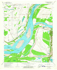
1966 Map of Fletcher Lake
USGS Topo · Published 1967About this map
The Mississippi River defines this landscape south of Memphis, serving as a boundary between the heavy industrial works of Tennessee and the low-lying agricultural drainage of Arkansas. On the eastern bank, the Allen Generating Plant and associated Tailings Pond signal the mid-century industrial expansion, while the Chucalissa Archaeological Park and T O Fuller State Park preserve significant cultural and natural terrain. The river itself is dominated by massive landforms like Vice Presidents Island and Presidents Island No 45, which separate the main channel from Mc Kellar Lake. Across the water in Arkansas, the grid of the Proctor district is crisscrossed by railroads including the Chicago Rock Island and Pacific. This area is dotted with small rural nodes like Waverly, Riceville, and Millers, alongside many local landmarks such as St Johns Cem and Lake Grove Ch.
Find a feature on this map
51 named features on this map. Tap any name to fly to it.
Don’t see what you’re looking for? This feature index may not catch every label — zoom into the map to look around manually.
Map Details
Editions of this 1966 Fletcher Lake Map
4 editions found
Other maps of this area

1908 · Lake Cormorant
USGS Topo · 1:24,000

1912 · Lake Cormorant
USGS Topo · 1:31,680

1916 · Memphis
USGS Topo · 1:62,500

1925 · Memphis
USGS Topo · 1:48,000

1927 · Memphis
USGS Topo · 1:62,500

1931 · Horseshoe Lake
USGS Topo · 1:62,500

1932 · Horn Lake
USGS Topo · 1:48,000

1935 · Horn Lake
USGS Topo · 1:62,500

1939 · Horseshoe Lake
USGS Topo · 1:62,500

1939 · Edmondson
USGS Topo · 1:62,500