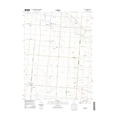
2013 Map of Fletcher
USGS Topo · Published 2013About this map
Fletcher and the surrounding rural landscape of Miami, Shelby, and Champaign Counties are defined by a network of agricultural homesteads and traditional burial grounds. The village of Fletcher sits at the intersection of Us-36 and Oh-589, anchored by the Fletcher Presbyterian Churchyard and nearby Fletcher Cem. This 2013 survey illustrates the enduring patterns of Ohio's farming history, with named agricultural properties such as Progress Farms, RCT Farm, and Futureama Farms scattered throughout the territory. The map is particularly valuable for genealogists, as it meticulously identifies numerous family-named cemeteries including Sturm Cem, Neal Cem, and Dorsey Cem, often located near watercourses like Mosquito Cr or Leatherwood Cr. To the north and east, small settlements like Plattsville, Tawawa, and Lena provide a clear view of the historical hamlet development along established routes like Sidney Plattsville RD.
Find a feature on this map
67 named features on this map. Tap any name to fly to it.
Don’t see what you’re looking for? This feature index may not catch every label — zoom into the map to look around manually.
Map Details
Editions of this 2013 Fletcher Map
This is the sole edition of this map. No revisions or reprints were ever made.
Other maps of this area

1913 · Bellefontaine
USGS Topo · 1:48,000

1913 · Sidney
USGS Topo · 1:62,500

1914 · Troy
USGS Topo · 1:62,500

1914 · St. Paris
USGS Topo · 1:62,500

1915 · Bellefontaine
USGS Topo · 1:62,500

1916 · St. Paris
USGS Topo · 1:62,500

1944 · Sidney
USGS Topo · 1:62,500

1944 · St. Paris
USGS Topo · 1:62,500

1944 · Troy
USGS Topo · 1:62,500

1944 · Bellefontaine
USGS Topo · 1:62,500