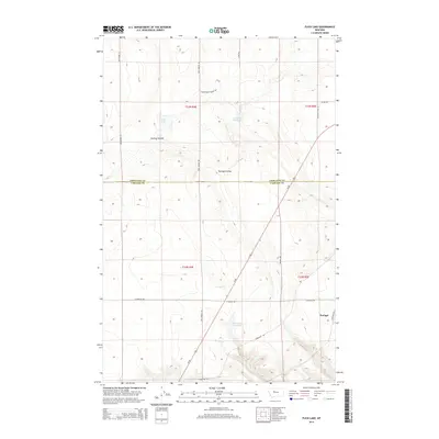
2014 Map of Flick Lake
USGS Topo · Published 2014About this map
The county line between Chouteau Co and Cascade Co divides this expansive landscape, defined by seasonal water and the rugged geography of the Great Plains. The small settlement of Portage sits near the southeastern corner, connected to the wider region by Us-87 and a network of rural routes like S Portage Rd. Local water sources are central to the area's utility, including Flick Lake, the Dick Golie Fish Pond, and Twenty-eight Mile Spring. The terrain is marked by significant drainages such as Huntley Coulee and Portage Coulee, which dictate the placement of roads like Dent Bridge Rd and Whitehorn Ln. This 2014 survey captures the persistence of these rural Montana townships, where land management and sparse settlements define the character of the high plains.
Find a feature on this map
23 named features on this map. Tap any name to fly to it.
Don’t see what you’re looking for? This feature index may not catch every label — zoom into the map to look around manually.
Map Details
Editions of this 2014 Flick Lake Map
This is the sole edition of this map. No revisions or reprints were ever made.
Other maps of this area

1886 · Great Falls
USGS Topo · 1:250,000

1948 · Portage
USGS Topo · 1:62,500

1949 · Portage
USGS Topo · 1:62,500

1949 · Timber Coulee
USGS Topo · 1:62,500

1949 · Great Falls
USGS Topo · 1:62,500

1950 · Timber Coulee
USGS Topo · 1:62,500

1950 · Dent Bridge
USGS Topo · 1:62,500

1951 · Great Falls
USGS Topo · 1:62,500

1954 · Great Falls
USGS Topo · 1:250,000

1957 · Great Falls
USGS Topo · 1:250,000