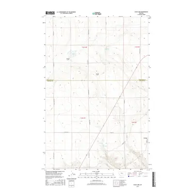
2017 Map of Flick Lake
USGS Topo · Published 2017About this map
Portage sits at the eastern edge of this High Plains landscape, where the border between Chouteau and Cascade Counties cuts through a region defined by seasonal water and deep drainages. The topography is shaped by prominent erosional features like Huntley Coulee and Portage Coulee, which carve through the plains toward the Missouri River valley just beyond the map's boundary. Ranching and land management are evident in the naming of local water sources and infrastructure, including Twentyweight Mile Spring and the Dick Golie Fish Pond. A grid of section lines and gravel routes, such as Whitehorn Ln and Dent Bridge Rd, provides access to the interior. The presence of Flick Lake in the northwest corner highlights the scattered wetlands that characterize this part of Montana's central plateau.
Find a feature on this map
21 named features on this map. Tap any name to fly to it.
Don’t see what you’re looking for? This feature index may not catch every label — zoom into the map to look around manually.
Map Details
Editions of this 2017 Flick Lake Map
This is the sole edition of this map. No revisions or reprints were ever made.
Other maps of this area

1886 · Great Falls
USGS Topo · 1:250,000

1948 · Portage
USGS Topo · 1:62,500

1949 · Portage
USGS Topo · 1:62,500

1949 · Timber Coulee
USGS Topo · 1:62,500

1949 · Great Falls
USGS Topo · 1:62,500

1950 · Timber Coulee
USGS Topo · 1:62,500

1950 · Dent Bridge
USGS Topo · 1:62,500

1951 · Great Falls
USGS Topo · 1:62,500

1954 · Great Falls
USGS Topo · 1:250,000

1957 · Great Falls
USGS Topo · 1:250,000