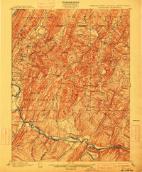
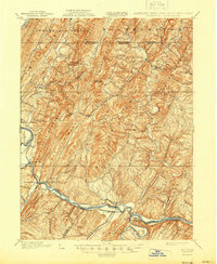
1900 Map of Flintstone
USGS Topo · Published 1913About this map
Potomac River and the South Branch Potomac River define the southern boundary of this late nineteenth-century landscape, where industrial transport corridors cut through the ridge-and-valley terrain. The C. & O. Canal follows the river’s winding course, paralleled by the Baltimore and Ohio Railroad, which services critical stops like Patterson Depot and South Branch Depot. This infrastructure supported a network of small milling and agricultural communities, including Cooks Mills and Wolfe Mill, while the Turnpike provided passage through the northern gaps.
Find a feature on this map
87 named features on this map. Tap any name to fly to it.
Don’t see what you’re looking for? This feature index may not catch every label — zoom into the map to look around manually.
Map Details
Editions of this 1900 Flintstone Map
6 editions found
Other maps of this area

1891 · Romney
USGS Topo · 1:125,000

1894 · Winchester
USGS Topo · 1:125,000

1898 · Frostburg
USGS Topo · 1:62,500

1898 · Paw Paw
USGS Topo · 1:62,500

1899 · Flintstone
USGS Topo · 1:62,500

1900 · Pawpaw
USGS Topo · 1:62,500

1900 · Flintstone
USGS Topo · 1:62,500

1901 · Frostburg
USGS Topo · 1:62,500

1908 · Frostburg
USGS Topo · 1:62,500

1910 · Paw Paw
USGS Topo · 1:62,500