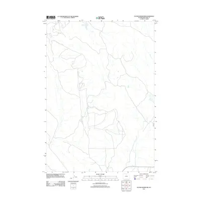
2012 Map of Flitner Reservoir
USGS Topo · Published 2012About this map
Hyatt Ranch and its surrounding ranchland define this Big Horn County landscape, captured during the early 21st century. The map reveals a managed water system essential for high-plains agriculture and livestock, centered around the Flitner Reservoir and Walters Reservoir. The infrastructure of the area is underscored by the Anita Ditch, a significant irrigation feature that cuts across the terrain near Alkali Cr. Local transit is represented by Alkali Rd, which provides access through this drainage basin. The map serves as a record of land use in a region where water management through reservoirs and ditches dictated the viability of homesteads and modern ranching operations.
Find a feature on this map
7 named features on this map. Tap any name to fly to it.
Don’t see what you’re looking for? This feature index may not catch every label — zoom into the map to look around manually.
Map Details
Editions of this 2012 Flitner Reservoir Map
This is the sole edition of this map. No revisions or reprints were ever made.
Other maps of this area

1955 · Sheridan
USGS Topo · 1:250,000

1958 · Sheridan
USGS Topo · 1:250,000

1960 · White Sulphur Spring
USGS Topo · 1:24,000

1960 · Flitner Reservoir
USGS Topo · 1:24,000

1960 · Hyatt Ranch
USGS Topo · 1:24,000

1960 · Manderson NE
USGS Topo · 1:24,000
1960 · Bush Butte
USGS Topo · 1:24,000

1960 · Manderson SE
USGS Topo · 1:24,000

1962 · Sheridan
USGS Topo · 1:250,000
1967 · Hyattville
USGS Topo · 1:24,000