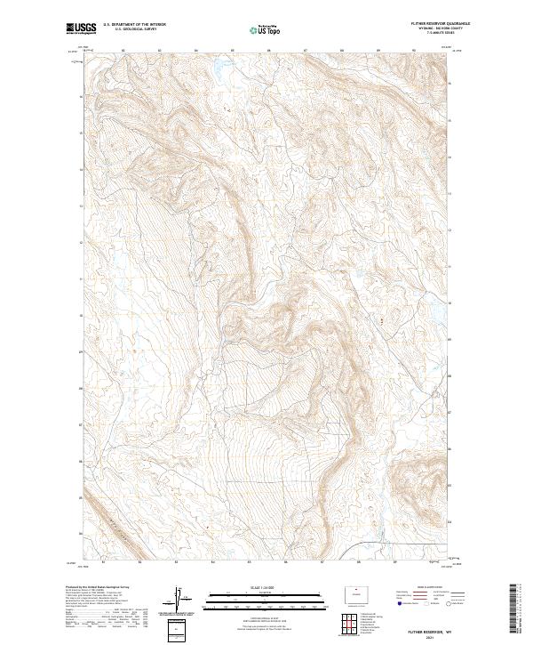
2021 Map of Flitner Reservoir
USGS Topo · Published 2021About this map
Flitner Reservoir sits at the northern edge of this high-plains landscape in Big Horn County, where the topography is defined by the sharp elevations of Blue Ridge. The area is characterized by a sparse network of seasonal watercourses and man-made irrigation features, reflecting the essential management of water in this arid environment. Key drainages such as Spring Cr and McCall Cr cut through the terrain, while the Anita Ditch highlights the historical efforts to divert water for agricultural use in the basin. This survey provides a precise look at the land division system across several townships, including t50n r90w and t51n r91w, showing how natural contours and water rights shaped the development of this rural Wyoming territory into the twenty-first century.
Find a feature on this map
12 named features on this map. Tap any name to fly to it.
Don’t see what you’re looking for? This feature index may not catch every label — zoom into the map to look around manually.
Map Details
Editions of this 2021 Flitner Reservoir Map
This is the sole edition of this map. No revisions or reprints were ever made.
Other maps of this area

1955 · Sheridan
USGS Topo · 1:250,000

1958 · Sheridan
USGS Topo · 1:250,000

1960 · White Sulphur Spring
USGS Topo · 1:24,000

1960 · Flitner Reservoir
USGS Topo · 1:24,000

1960 · Hyatt Ranch
USGS Topo · 1:24,000

1960 · Manderson NE
USGS Topo · 1:24,000
1960 · Bush Butte
USGS Topo · 1:24,000

1960 · Manderson SE
USGS Topo · 1:24,000

1962 · Sheridan
USGS Topo · 1:250,000
1967 · Hyattville
USGS Topo · 1:24,000