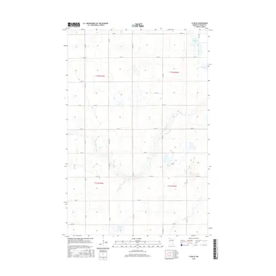
2016 Map of Flom SE
USGS Topo · Published 2016About this map
The S Br Wild Rice River meanders through the western half of this Becker County landscape, defining the hydrology of a region characterized by numerous glacial wetlands and small lakes. In the eastern portion, the headwaters of the Buffalo River and the quiet waters of Cucumber Lake and Lemon Lake anchor the terrain. The map reveals a strictly organized grid of rural infrastructure, where routes like Mn Main Hwy and Co Rd 18 segment the land into regular sections. This 2016 survey documents a modern prairie landscape where water management and agriculture are inextricably linked, visible in the way the river systems and Balke Lake are interspersed with a dense network of township roads such as 150th Ave and 350th St. It is a detailed record of the upper Midwest's rural geometry and its natural drainage patterns.
Find a feature on this map
28 named features on this map. Tap any name to fly to it.
Don’t see what you’re looking for? This feature index may not catch every label — zoom into the map to look around manually.
Map Details
Editions of this 2016 Flom SE Map
This is the sole edition of this map. No revisions or reprints were ever made.
Other maps of this area

1918 · Flom
USGS Topo · 1:62,500

1952 · Grand Forks
USGS Topo · 1:250,000

1953 · Fargo
USGS Topo · 1:250,000

1953 · Brainerd
USGS Topo · 1:250,000

1954 · Bemidji
USGS Topo · 1:250,000

1956 · Fargo
USGS Topo · 1:250,000

1956 · Grand Forks
USGS Topo · 1:250,000

1957 · Brainerd
USGS Topo · 1:250,000

1957 · Bemidji
USGS Topo · 1:250,000

1958 · Bemidji
USGS Topo · 1:250,000