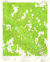
1960 Map of Flomaton
USGS Topo · Published 1961About this map
The Escambia River defines the landscape of this Gulf Coast borderland, winding southward through a network of creeks like Pond Creek and Sizemore Creek toward the Florida state line. The rail infrastructure of the Louisville and Nashville Railroad serves as the primary artery for the region, centering on the junction at Flomaton. This era is marked by a transition from older logging routes, evidenced by the Old Railroad Grade in the northwest, toward an economy increasingly reliant on industrial extraction, shown by the numerous Gravel Pits and Sand and Gravel Pits along the riverbanks. Family and community life is anchored by dispersed rural settlements like Moyeville and Wawbeek, each clustered around local landmarks such as Moyeville Ch and several small burial grounds including Hammac Cem and Travelers Rest Cem.
Find a feature on this map
45 named features on this map. Tap any name to fly to it.
Don’t see what you’re looking for? This feature index may not catch every label — zoom into the map to look around manually.
Map Details
Editions of this 1960 Flomaton Map
2 editions found
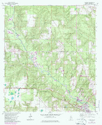
Other maps of this area

1941 · Century
USGS Topo · 1:62,500

1943 · Century
USGS Topo · 1:62,500

1943 · Jay
USGS Topo · 1:62,500

1953 · Andalusia
USGS Topo · 1:250,000

1957 · Andalusia
USGS Topo · 1:250,000

1957 · Pensacola
USGS Topo · 1:250,000

1959 · Pensacola
USGS Topo · 1:250,000

1960 · Pensacola
USGS Topo · 1:250,000

1960 · Atmore
USGS Topo · 1:24,000

1960 · Huxford
USGS Topo · 1:24,000