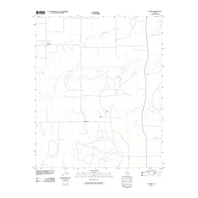
2010 Map of Flomot
USGS Topo · Published 2010About this map
Flomot and the surrounding plains of Motley County define this landscape, where the agricultural grid meets the drainage of the North Pease River. The settlement at Whitestar serves as a secondary focal point south of the river, connected by FM 2009. Water sources are critical in this part of West Texas, evidenced by the named cattle-country landmarks West Windmill and Twin Windmill located in the rolling breaks between the river and the southern creeks. The hydrological network is well-documented, showing the winding course of Alamosa Creek in the north and the expansive reach of Tom Ball Creek and Miller Springs in the southwest, illustrating the vital role of intermittent waterways in this ranching and farming region.
Find a feature on this map
22 named features on this map. Tap any name to fly to it.
Don’t see what you’re looking for? This feature index may not catch every label — zoom into the map to look around manually.
Map Details
Editions of this 2010 Flomot Map
This is the sole edition of this map. No revisions or reprints were ever made.
Other maps of this area

1954 · Plainview
USGS Topo · 1:250,000

1958 · Plainview
USGS Topo · 1:250,000

1966 · Matador
USGS Topo · 1:24,000

1967 · Quitaque
USGS Topo · 1:24,000

1967 · North Windmill
USGS Topo · 1:24,000

1967 · Quitaque Peaks
USGS Topo · 1:24,000

1967 · Dick Moore Canyon
USGS Topo · 1:24,000

1967 · Hornica Creek
USGS Topo · 1:24,000

1967 · Flomot
USGS Topo · 1:24,000

1967 · Whiteflat
USGS Topo · 1:24,000