
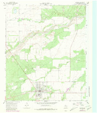
1966 Map of Matador
USGS Topo · Published 1968About this map
Matador serves as the primary hub of this West Texas landscape, showing a structured grid of residential streets and civic institutions in the mid-1960s. The town's layout includes essential community landmarks such as the High Sch and the East Mound Cem located just east of the main settlement. Outside the town center, the terrain is defined by the winding course of the Middle Pease River to the north and its various tributaries, including Longs Branch and Ballard Creek.
Find a feature on this map
11 named features on this map. Tap any name to fly to it.
Don’t see what you’re looking for? This feature index may not catch every label — zoom into the map to look around manually.
Map Details
Editions of this 1966 Matador Map
2 editions found
Other maps of this area

1954 · Lubbock
USGS Topo · 1:250,000

1954 · Plainview
USGS Topo · 1:250,000

1958 · Plainview
USGS Topo · 1:250,000

1966 · Ballard Camp
USGS Topo · 1:24,000

1967 · Hornica Creek
USGS Topo · 1:24,000

1967 · Turtle Hole Camp
USGS Topo · 1:24,000

1967 · Flomot
USGS Topo · 1:24,000

1967 · Whiteflat
USGS Topo · 1:24,000

1968 · Mac Bain
USGS Topo · 1:24,000

1968 · Roaring Springs
USGS Topo · 1:24,000